No weapon formed against you shall prosper, And every tongue which rises against you in judgment you shall condemn. This is the heritage of the servants of the LORD, "And their righteousness is from Me," Says the LORD. Isaiah 54:17
MOUNT VEMA
17 YEARS OF ROYAL HISTORY
Home | Contact | News | Banking | Currency | Shopping | Freight | Travel | Jobs | Real Estate | Weather | Search | 912 Emergencies | LOG IN


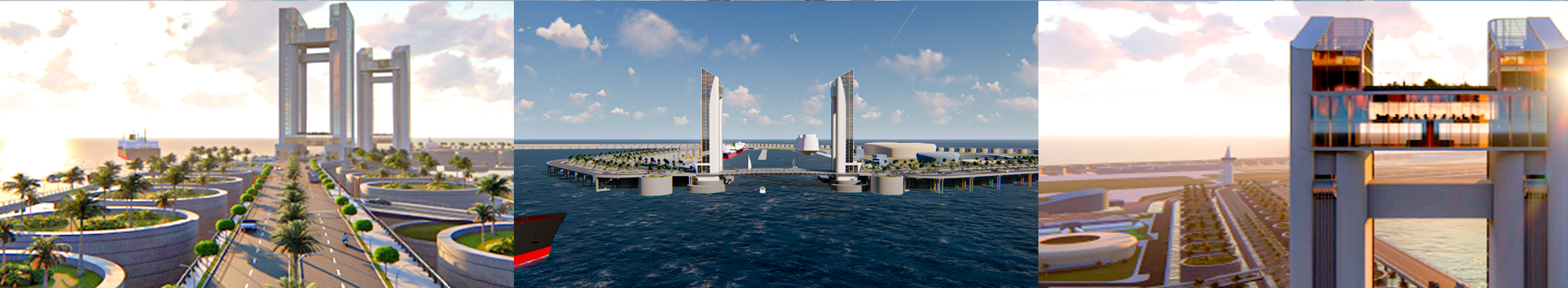
The Legal Entities of Mount Vema

|
COUNTRY
|
COUNTRY CODE
COUNTRY CODES IN USE Mount Vema Country Code: OV / MOV Mount Vema Numeric Country Code: 507 Currency Code: VSG Top-Level Domain: .com, and .ov (proposed) Proposed Telephone Country Code: +294 |
|
International Treaties – Ratified by the Kingdom of Mount Vema
Law of the Sea Treaty (United Nations Convention on the Law of the Sea) MARPOL 73/78 (Convention for the Prevention of Pollution from Ships) The Vienna Convention on Diplomatic Relations of 1961 The Vienna Convention on Consular Relations 1963 |
State Alert! – Security, Public Safety and Emergencies
YELLOW WARNING official advise to be aware. >>>
AMBER WARNING official advise to be prepared. >>>
RED WARNING official advise to take action as instructed by the emergency services. >>>
AMBER WARNING official advise to be prepared. >>>
RED WARNING official advise to take action as instructed by the emergency services. >>>