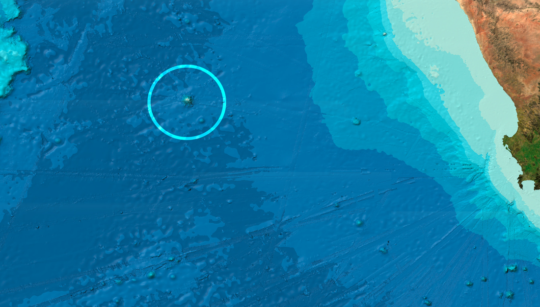
Vema Seamount
Vema Seamount (Mount Vema) is a volcanic rock, an intraplate volcano known as the 'Vema hotspot' which have moved farther west, about 200 kilometres, after it was created more than 11 million years ago. The island which eroded to be later known as a sea mount was discovered by a vessel called Vema, and became known as Vema Seamount, which is now with its adjacent waters a sovereign territory controlled by the Vema Seamount Authority.
|
|
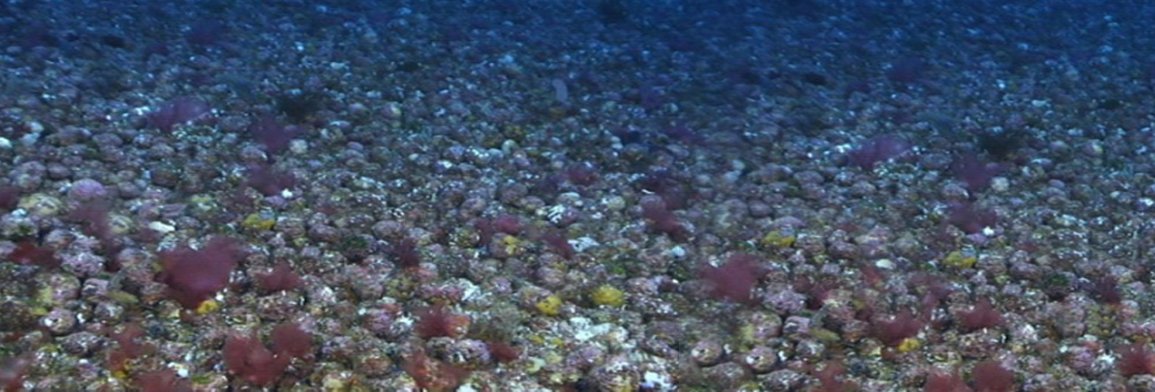
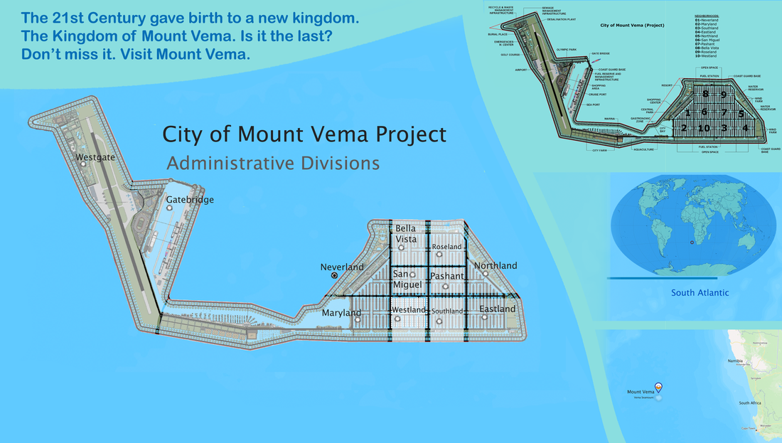
When people think of Mount Vema or Vema Seamount today, images of water, fishery, royalty and wealth spring to mind. However this unique South East Atlantic territory, is not just a submerged ancient island, once at the surface of the sea which eroded by millions of years of wave action. Mount Vema is a monument, a piece of rock inextricably linked with The Vema Seamount Authority - Peter J. Goldishman who has managed to propel this once over-fished and almost forgotten submerged island, to a well-managed and well-regulated fishing ground, and transformed it, to its greatest ever imagined state of wealth and prominence. Kingdom of Mount Vema is now the official country name, and City of Mount Vema is the floating city project, aiming to be the largest and the only floating City-State in the world.
A submerged island, not a Seamount - 1966 and 2014 Findings
A study published by the Government of Mount Vema agreed with the views of the University of Cape Town and Nature Publishing Group published in 1966 of the probability that Vema Seamount was once an island at the surface of the sea.
In 2014, The Royal Foundation Academy of Mount Vema concluded in its report presented to His Majesty King Peter Jon Goldishman that its findings were very similar to that reported by Heirtzler James in 1966 titled 'Magnetic Anomaly over Vema Seamount'. The Heirtzler James 1966 Report states that the fact that Vema Seamount magnetization is not exactly reversed suggested that Vema Seamount is not homogeneously magnetized, due perhaps to differential deformation. The theory was supported by the Royal Foundation Academy of Mount Vema in 2014 who also believes based on its own findings that the deformation and the millions of years of wave action eroded the island from the time when the top was at the surface of the sea and planed it off, which explains the Vema Seamount’s flat top.
Heirtzler James 1966 findings report and the Royal Foundation Academy of Mount Vema findings in 2014, both indicate that the magnetic anomaly of Vema Seamount shows the negative part of the anomaly pattern occurring towards magnetic north relative to the positive part of the pattern, indicating that the seamount could not have been formed at a time when the earth's magnetic field was in its present direction, but rather at a time when the field was in nearly the opposite direction.
His Majesty’s Government of Mount Vema officially concluded that Vema Seamount is therefore much older than previously thought and it was once an island at the surface of the sea. What remains of the island is what made the world community record it as a seamount, and not as a special island, or as a submerged island as it should have been recorded as.
The Island - read more
No weapon formed against you shall prosper, And every tongue which rises against you in judgment you shall condemn. This is the heritage of the servants of the LORD, "And their righteousness is from Me," Says the LORD. Isaiah 54:17

MOUNT VEMA
17 YEARS OF ROYAL HISTORY
Home | Contact | News | Banking | Currency | Shopping | Freight | Travel | Jobs | Real Estate | Weather | Search | 912 Emergencies | LOG IN


The Legal Entities of Mount Vema


|
COUNTRY
|
COUNTRY CODE
COUNTRY CODES IN USE Mount Vema Country Code: OV / MOV Mount Vema Numeric Country Code: 507 Currency Code: VSG Top-Level Domain: .com, and .ov (proposed) Proposed Telephone Country Code: +294 |
|
International Treaties – Ratified by the Kingdom of Mount Vema
Law of the Sea Treaty (United Nations Convention on the Law of the Sea) MARPOL 73/78 (Convention for the Prevention of Pollution from Ships) The Vienna Convention on Diplomatic Relations of 1961 The Vienna Convention on Consular Relations 1963 |
State Alert! – Security, Public Safety and Emergencies
YELLOW WARNING official advise to be aware. >>>
AMBER WARNING official advise to be prepared. >>>
RED WARNING official advise to take action as instructed by the emergency services. >>>
AMBER WARNING official advise to be prepared. >>>
RED WARNING official advise to take action as instructed by the emergency services. >>>